Multisectoral and integrated territorial diagnosis of the northeastern part of El Salvador at a scale of 1:25,000 including:
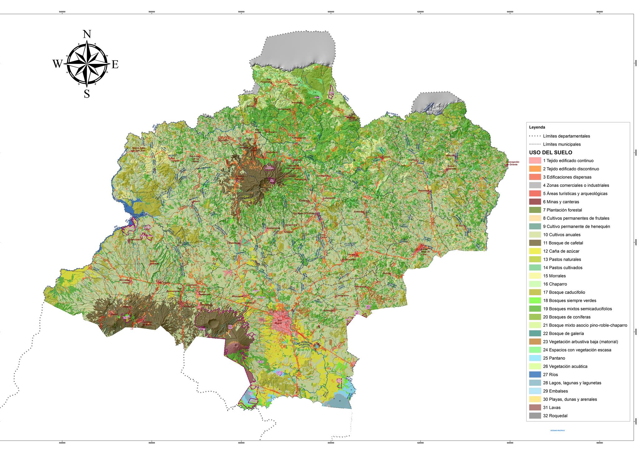
Land use map 2016 purified and improved with field verification Sectoral Diagnostic Documents of the Northeastern Zone of El Salvador at a scale of 1:25,000:
- Physical (geological, soil, agrological, hydrological and hydrogeological, all aimed at identifying characteristics, potentialities, threats – drought, floods, landslides, etc. – and restrictions or conditioning of the territory).
- Ecological (natural terrestrial and aquatic ecosystems, identifying biodiversity and associated ecosystem services.)
- Socio-economic (land use and economic and/or social dynamics/trends causing pressures and impacts on the environment and natural resources in urban and rural areas).
- Climate: analysis of territorial vulnerability to climate change and of average precipitation and temperature of current conditions and climate change scenarios. Integrated diagnostic document of the north-eastern part of El Salvador at a scale of 1:25,000, linking sectoral diagnoses and including conclusions.
- Memory of spatial analysis processes performed, including metadata of all Information used and generated. Digital archives in GIS format of the cartography generated and cartographic models used. Analysis of the differentiated vocation of the territory and the guidelines for environmental zoning Methodological proposal of a cartographic territorial analysis to determine the differentiated vocation of the territory, by a multidisciplinary team. Proposed development of zoning guidelines scale 1:25,000. Document systematizing the process of discussion and consensus between consultants and GOA team. Cartography (geodatabase GIS and mxd) scale 1:25,000 of all products with metadata. Mapping and guidelines for environmental zoning in the north-eastern part of El Salvador
Type of services provided
Multisectoral and integrated territorial diagnosis of the north-eastern part of
El Salvador at a scale of 1:25,000
- Physical and Risk Diagnosis.
- Ecological Diagnosis.
- Socioeconomic Diagnosis.
- Climate Diagnosis (including WRF model processing)
- Cartography in geodatabase GIS format.
Analysis of the different vocation of the territory and the guidelines for environmental zoning.
Mapping and guidelines for environmental zoning in the north-eastern part of El Salvador
- Geographic database, digital GIS files of the cartography generated and cartographic models used.
- Environmental zoning document. Elements to define the vocation and carrying capacity of the resulting areas.
- Guidelines for action linked to areas, categories and subcategories in cartography.
- Mechanisms for incorporation into territorial planning